


Description
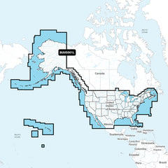
xNavionics+™ BUS001L U.S. & Coastal Canada Built-In Chart Updates - microSD™/SD™ & 1-Year Subscription
UPDATE TO GARMIN NAVIONICS+™ CARTOGRAPHY
If your chartplotter came with built-in BlueChart® g3 coastal charts or LakeVü™ g3 inland maps, a plug-in microSD™ card makes it easy to upgrade with our latest Garmin Navionics+ all-in-one mapping solution. Check chartplotter compatibility.
- Navigate with our best offshore and inland lake coverage for your Garmin chartplotter.
- See it your way. Customize your view with various chart layers and overlay combinations.
- With your included one-year subscription, access daily updates via the ActiveCaptain® smart-device app.
- Auto Guidance+™ technology1 lets you navigate with suggested dock-to-dock routings.
- Select up to 10 color-shaded target depth ranges to scope out the best fishing spots.
- Save money by renewing your subscription — and continue accessing daily updates plus new content downloads.
ALL-IN-ONE MAP SOLUTION FOR GARMIN CHARTPLOTTERS
Access detail-rich mapping of coastal features, lakes, rivers, and more. Integrated Garmin and Navionics content offers coverage for boaters worldwide.
DAILY CHART UPDATES
Charts are constantly being enhanced with new and amended content — as many as 5,000 updates are made every day. The one-year included subscription gives you access to daily chart updates via the ActiveCaptain app.
AUTO GUIDANCE+ TECHNOLOGY
Combining the best of Garmin and Navionics automatic routing features, built-in Auto Guidance+ technology1 gives you a suggested dock-to-dock path to follow through channels, inlets, marina entrances, and more.
DEPTH RANGE SHADING
High-resolution depth range shading lets you select up to 10 color-shaded options and view your designated target depths at a glance.
UP TO 1’ CONTOURS
For improved fishing and navigation, up to 1' contours provide a clear depiction of bottom structure for improved fishing charts and enhanced detail in swamps, canals, harbors, marinas, and more.
SHALLOW WATER SHADING
To give a clear picture of shallow waters to avoid, this feature allows for shading at a user-defined depth.
RASTER CARTOGRAPHY
NOAA raster cartography2 is available for some U.S. waters as a free downloadable feature via the ActiveCaptain app to provide paper chart-like views on your plotter.
ACTIVECAPTAIN COMMUNITY
Community-sourced content provides useful POIs, such as marinas, anchorages, hazards, businesses, and more. Get recommendations from boaters with firsthand experience of the local environment.
1 Auto Guidance+ is for planning purposes only and does not replace safe navigation operations
2 Raster cartography cannot be viewed on echoMAP™ CHIRP and ECHOMAP™ Plus combos but can be viewed on mobile devices via the ActiveCaptain mobile app
Shipping & Return
xShipping
We ship orders across USA, If your order is in stock and we process the charges to your credit card, it will ship within one business day from the date of your order. We will send you tracking information within 24 hours of your order leaving the warehouse to the e-mail address you provided when checking out. If you do not receive tracking information from us within three business days of your order, feel free to follow up with us at help@roamridge.com We offer free economy shipping for orders above $99, also we offer various flat shipping rates across the USA, However please also note that some products such as oversized, Truck shipping items are not covered in free or flat shipping rates. Please verify at checkout before making payment.
Overnight and Two day shipping orders will be shipped the same day if order is received before 2PM CST.
Returns Policy
Roam Ridge offers a return period of 30 days from date of receipt. Return Merchandise Authorization (RMA) numbers are required for all returns. Returned products must be complete in the original packaging and resalable. Non-stock items may not be returned. Opened and/or unsealed DVDs, CDs, and cartography are not returnable unless defective. Units requiring service, either warranty or otherwise, should be returned directly to the appropriate manufacturer. For most items, customers can obtain an RMA number and process their return using the Roam Ridge website. Customers may also obtain an RMA number by sending an email to help@roamridge.com Be sure to provide the original invoice number, product being returned, and the reason for return. Returned merchandise may be subject to a restocking fee of up to 15%.
- Choosing a selection results in a full page refresh.